A robot to better understand the biodiversity of seamounts.
The MECOPO Project
CONTEXT AND MAIN ISSUES
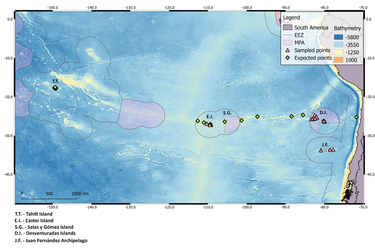
The Pacific Ocean has the highest number of seamounts and oceanic islands in the world. These topographic features host ecosystems that are particularly vulnerable to human impacts.
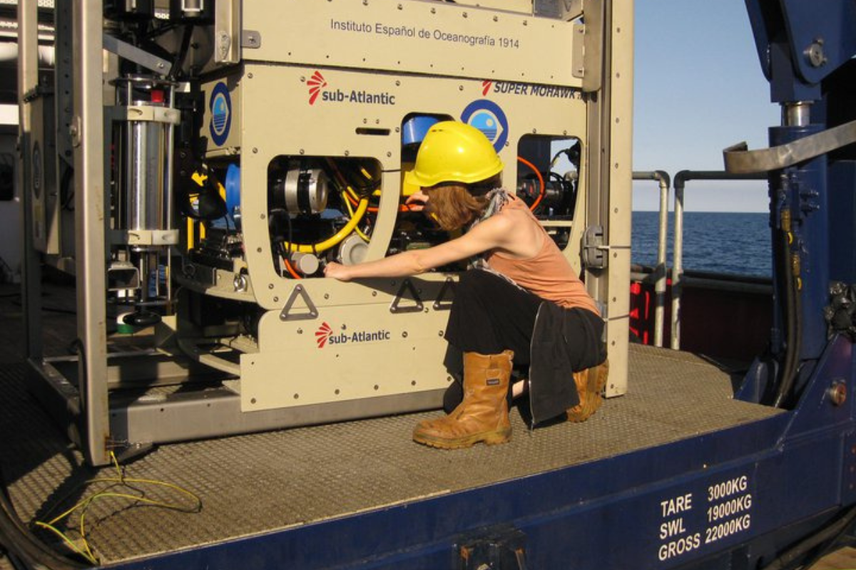
MECOPO focuses on the understudied yet essential marine biodiversity of these areas, at depths ranging from 60 to 350 meters, using a remotely operated underwater vehicle.
The state of biodiversity in the ocean is a major societal concern, as it is currently facing multiple stress factors linked to human activities and climate change. While marine ecosystems in populated coastal areas are already impacted, it remains unclear how remote systems respond to these stressors. MECOPO focuses on mesophotic benthic communities (attached to the seabed at depths of 60 to 350 meters), a key yet understudied component of marine biodiversity in oceanic islands and seamounts.
GOALS
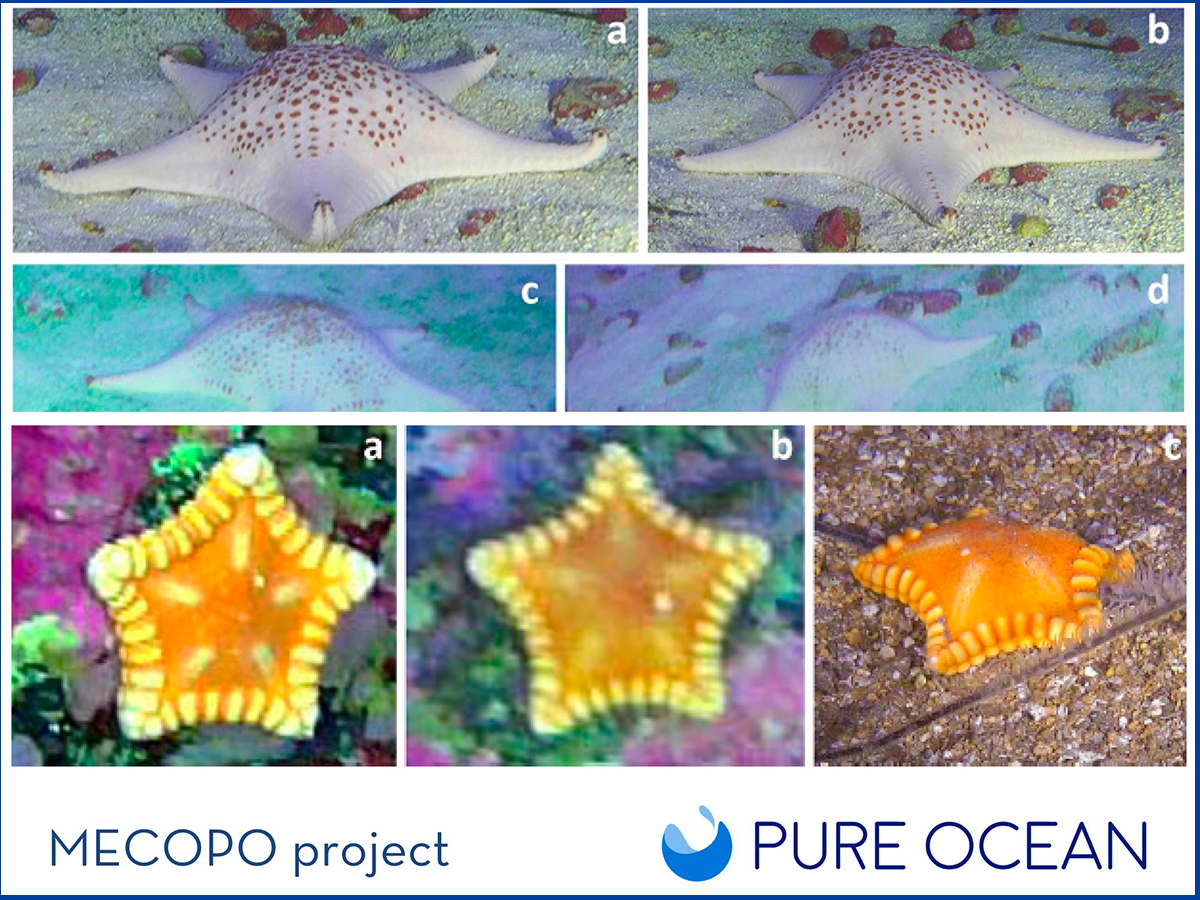
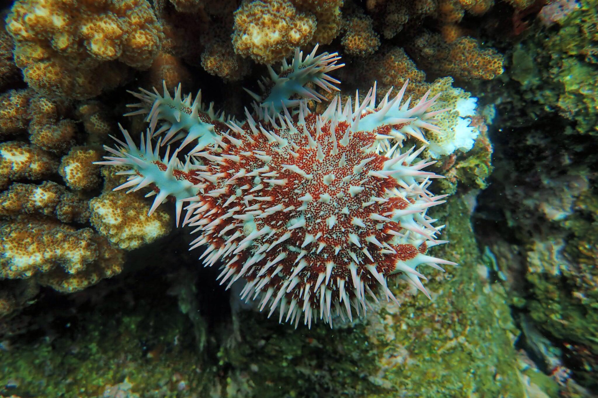
Discover how starfish and sea urchins from mesophotic communities (60 to 350 m deep) disperse and connect between oceanic islands and seamounts across the South Pacific.
Understand which areas may be more vulnerable to human-induced and natural changes, and their capacity to recover after disturbances.
METHOD
The state of biodiversity in the ocean is a major societal concern, as it is currently facing multiple stress factors linked to human activities and climate change. While marine ecosystems in populated coastal areas are already impacted, it remains unclear how remote systems respond to these stressors. MECOPO focuses on mesophotic benthic communities (attached to the seabed at depths of 60 to 350 meters), a key yet understudied component of marine biodiversity in oceanic islands and seamounts.
Ariadna and her team will characterize and compare these communities on oceanic islands and surrounding seamounts in two areas of the southeastern Pacific: Easter Island (EI) and the Desventuradas Islands (DI).
They will first build a database of the species inhabiting the selected islands. The data will then be interpreted in light of current ecological theories and ocean model simulations, in order to describe for the first time the biological connections between the different seamounts.
Cela aidera à identifier les zones susceptibles d’être sensibles aux changements anthropiques (par exemple, une modification potentielle du courant océanique qui modifie les schémas de dispersion larvaire, la destruction des possibilités de colonisation par bonds entre monts sous-marins et la reproduction) et les effets qu’ils pourraient avoir sur les communautés (par exemple : diminution de la biodiversité, apparition de nouvelles espèces, migration vers des zones plus profondes / moins profondes ou même extinction d’espèces).
This database will be a key asset for managing these highly vulnerable and relatively preserved ecosystems, notably by providing scientific evidence to support discussions on the creation of new marine protected areas.
HOW IS THIS PROJECT INNOVATIVE?
DEEPEX CARIB is first and foremost a pioneering exploration, one of the very first expeditions dedicated to the deep waters of Trinidad and Tobago, in areas that remain largely unexplored and rich in discovery potential.
The project combines state‑of‑the‑art technologies (deep‑sea ROVs, high‑resolution imaging, sonar mapping) with a multidisciplinary approach integrating biodiversity, geology, ecological connectivity and human impacts.
It also stands out for its strong local and social dimension: led by Caribbean scientists, the mission strengthens local capacities and ensures that data and samples directly benefit institutions in Trinidad and Tobago.
By generating essential baseline data, DEEPEX CARIB helps lay the foundations for durable, science‑based ocean protection in a region still largely absent from global deep‑sea conservation frameworks.
LOCATION
NEWS
Project duration
2019 – 2021
SUSTAINABLE DEVELOPMENT GOALS
Results and advances
Coming soon
Step 1
Lorem ipsum dolor sit amet, consectetur adipiscing elit. Ut elit tellus, luctus nec ullamcorper mattis, pulvinar dapibus leo.
Lorem ipsum dolor sit amet, consectetur adipiscing elit. Ut elit tellus, luctus nec ullamcorper mattis, pulvinar dapibus leo.
étape 2
Lorem ipsum dolor sit amet, consectetur adipiscing elit. Ut elit tellus, luctus nec ullamcorper mattis, pulvinar dapibus leo.
Lorem ipsum dolor sit amet, consectetur adipiscing elit. Ut elit tellus, luctus nec ullamcorper mattis, pulvinar dapibus leo.
étape 3
Lorem ipsum dolor sit amet, consectetur adipiscing elit. Ut elit tellus, luctus nec ullamcorper mattis, pulvinar dapibus leo.
Lorem ipsum dolor sit amet, consectetur adipiscing elit. Ut elit tellus, luctus nec ullamcorper mattis, pulvinar dapibus leo.
The team
Dr. Ariadna Mecho,
ESMOI, Universidad Católica del Norte
Partners
OCEANA Chile
Les pêcheurs et les communautés de Rapa-Nui
Scientific partners
Millennium Nucleus for Ecology and Sustainable Management of Oceanic Islands (ESMOI) Institut de Recherche pour le Développement (IRD)
Institutional Partners
First name Last name
Université, structure, asso,...
First name Last name
Université, structure, asso,...
First name Last name
Université, structure, asso,...